
G.I.S. Systems Development
The GIS System differs by the ability to manage and analyze multiple layers of georeferenced information on maps, this provides an expandability of information, improves the relationship of elements through their position or closeness and generates analysis in space and time.
This leads to an evolution of standard database by providing greater intelligence to the systems with BIG Data GIS.
We can see that our products specialize in technology that requires it, such as:
- Telecommunication.
- Logistic.
- Geo Marketing.
- Civil Engineering.
- Urban Planning.
Digitize and Automate your processes
By Incorporating Workflows and Machine Learning you will get everything
you need for your company’s processes to have a fast and effective response.
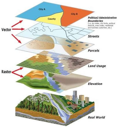 GIS's Levels
A geographic information system (GIS) is a computer-based tool for mapping and analyzing things that exist and events that happen on Earth. GIS technology integrates common database operations such as query and statistical analysis with the unique visualization and geographic analysis benefits offered by maps. These abilities distinguish GIS from other information systems and make it valuable to a wide range of public and private enterprises for explaining events, predicting outcomes, and planning strategies.
Map making and geographic analysis are not new, but a GIS performs these tasks better and faster than do the old manual methods. And, before GIS technology, only a few people had the skills necessary to use geographic information to help with decision making and problem solving.
The old adage "better information leads to better decisions" is as true for GIS as it is for other
information systems. A GIS, however, is not an automated decision making system but a tool to
query, analyze, and map data in support of the decision making process. GIS technology has
been used to assist in tasks such as presenting information at planning inquiries, helping resolve
territorial disputes, and siting pylons in such a way as to minimize visual intrusion.
GIS can be used to help reach a decision about the location of a new housing addition that has
minimal environmental impact, is located in a low risk area, and is close to a population center.
The information can be presented succinctly and clearly in the form of a map and accompanying
report, allowing decision makers to focus on the real issues rather than trying to understand the
data. Because GIS products can be produced quickly, multiple scenarios can be evaluated
efficiently and effectively.
Some of our GIS Solutions

Getting to Another Level of Design
When you need your company to have a new website or if you venture on updating your old webpage with a new look and functionality. the choices are versatile Assuming that you will goWhen you need your company to have a new website or if you venture on updating your old webpage with a new look and functionality.
Read More
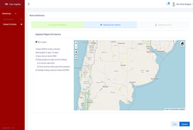
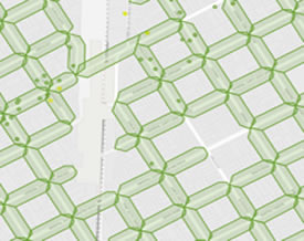
Network Engineering and Design
Digitization and integration module with other external data repositories to represent all the information of your Fiber Optic network in a single cloud map.
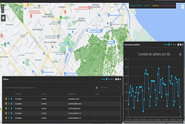
Control and Monitoring
This Module controls and tracks any activity on your assets, networks and regions of interest.
"Notice what is being done and about what"
We provide you with a thematic map in real time with all the works that involve some type of intervention of interest.
Network Support
Protect your customers by reducing affectation times for any event on your network.
Through our system we provide you with the Intelligence you need for your passive network. Detect the affectation in real time by obtaining the location of the cause.
"We have successful integrations with HP Temip"
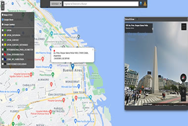
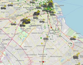
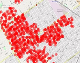
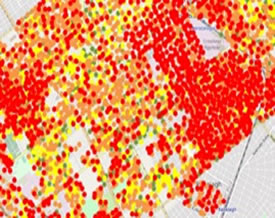
Commercialization and Geo Marketing
We have a marketing module for both FTTH and HFC networks, with a simple view and the updated status of the coverage and technical information, necessary to ensure a successful operation.
Get additional control methods to secure your sales
- Reserve availability instantly to generate a sale.
Update installations in real time.
Detail of the internal availability in buildings or housing complexes.
Penetration, hot zones and areas of high requirement to expand your networks.
Massive feasibility analysis.
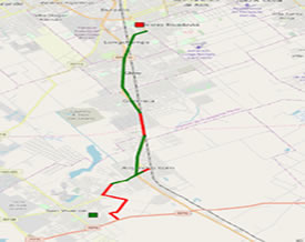
Logistics
We have multiple integrations with GPRS companies to meet your fleet tracking needs.
Additionally, we provide logistics control and reporting modules:
Programming of predefined routes for your vehicles.
Actions Schedule in route.
Speed Control.
Route Control.
Gathering information.
In this way you can have complete control of fleet movements, whether or not they meet the conditions previously defined in the system.
Posted By Zarcom Solutions
We are specialists in technological solutions